


Swan K1 Mapping Platform VTOL Drone
A Fixed-Wing UAV You've Never Imagined
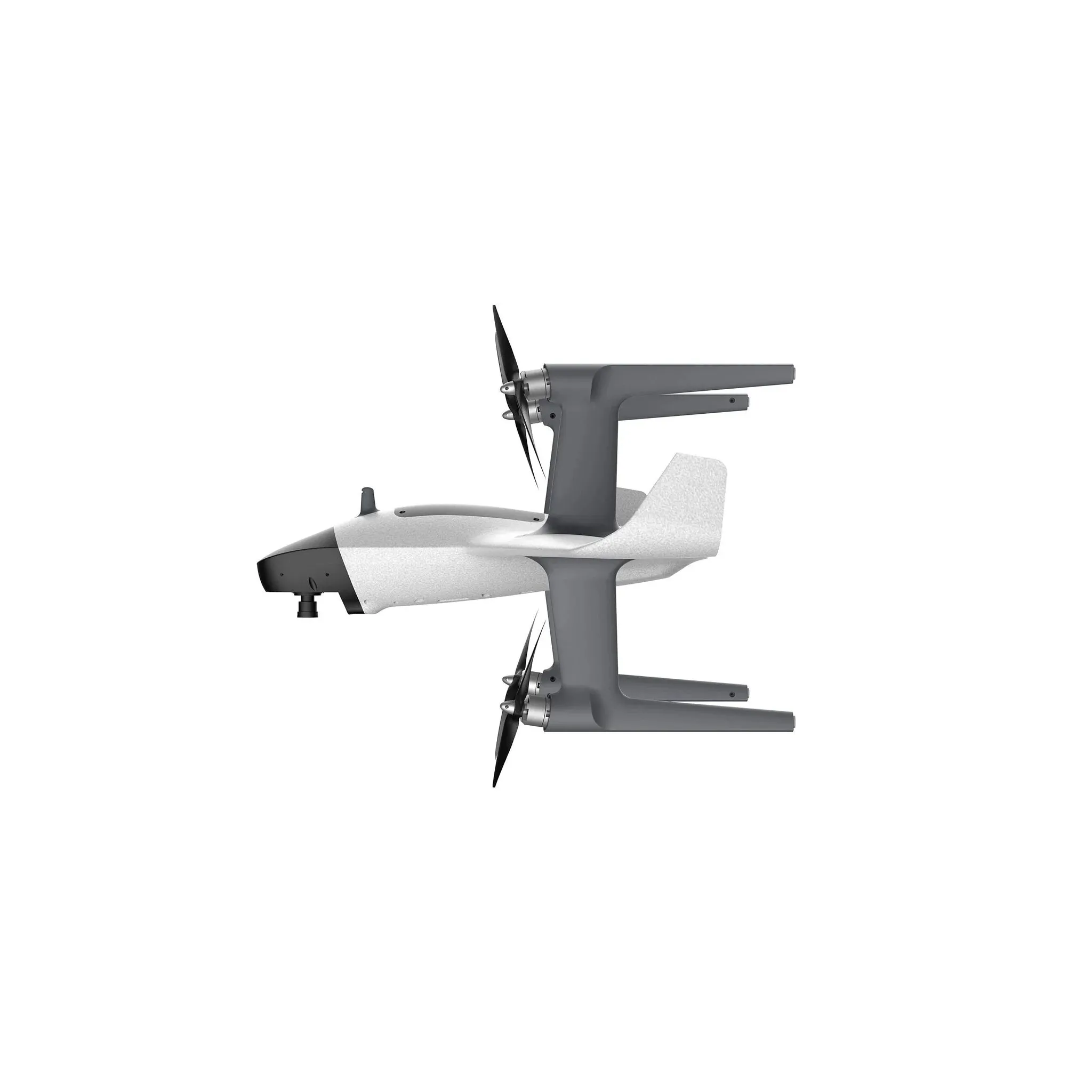
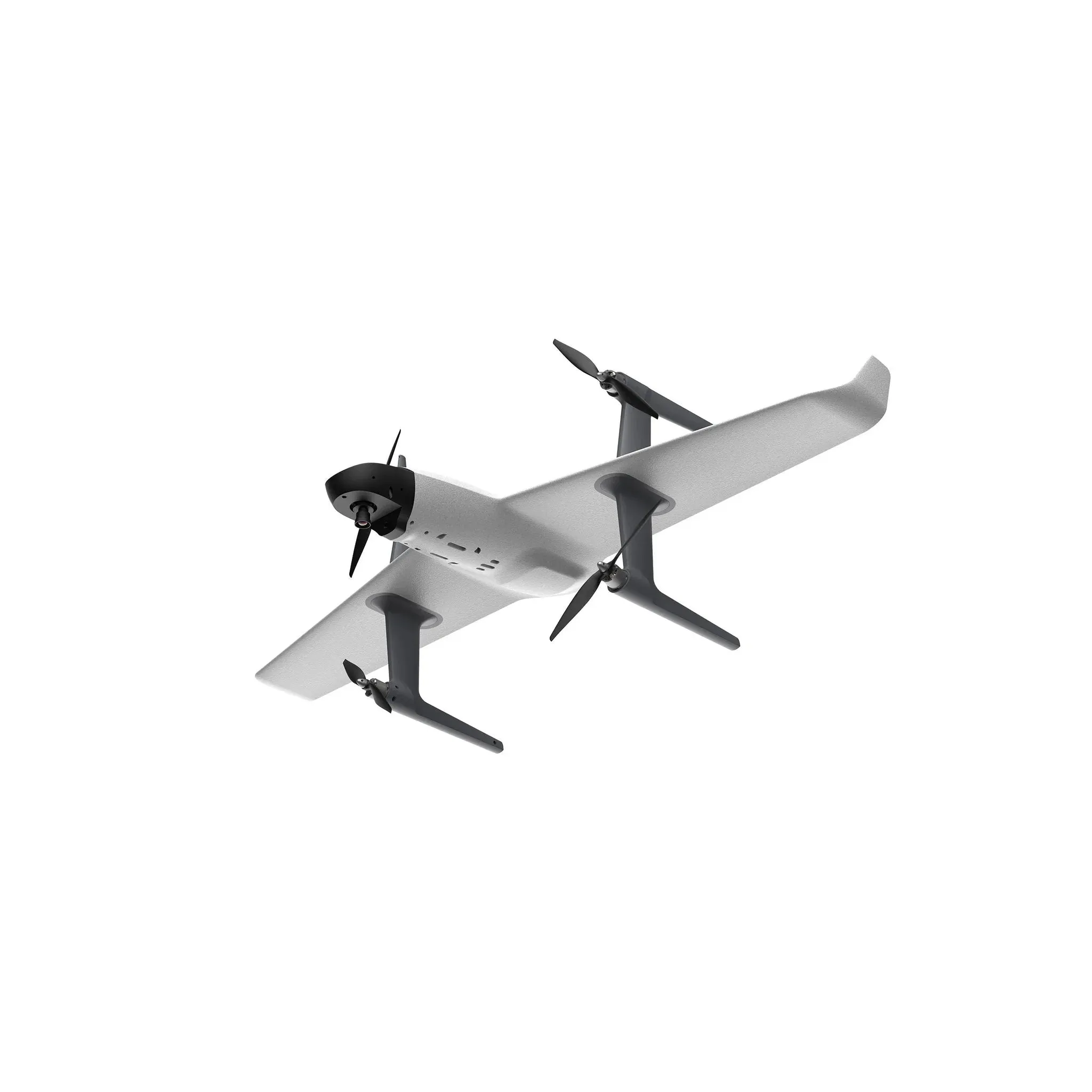
The Swan-K1 mapping is a Small Vtol UAV for surveying and mapping fixed-wing UA that can take off and land vertically as well as switch flight modes with one button. It adopts no rudder surface control technology, which brings users a minimalist control experience. The most important is it could get centimeter-accurate Map without GCPs (ground control points), which truly achieves GCPs-free control measurement.
Main features
- Vertical take-off and landing
- One-Click Switch
- Without rudder control
- Minimalist control experience
- 1 hour super long flight time
- Long voyage
- Zero Threshold Requirement
- Intelligent Return
- Centimeter-accurate Map without GCPs
One-Click Take-Off
Compared to the traditional fixed-wing drones, Swan K1 has one click take-off and one click return function, allowing it to switch between fixe-wing mode and rotor flight mode easily. You can command the flying skills as well in a few minutes without any experience of piloting a fixed-wing UAV or model airplane.
A Fixed-Wing UAV With Many Advantages
Swan-K1 mapping has the advantages of lightweight, portable, convenient disassembly and installation, single-person operation, long battery life, etc advantages. It can be used in surveying and mapping, measurement, remote inspection, power inspection, urban planning, energy projects, and road construction projects, Mine surveying and other industries.
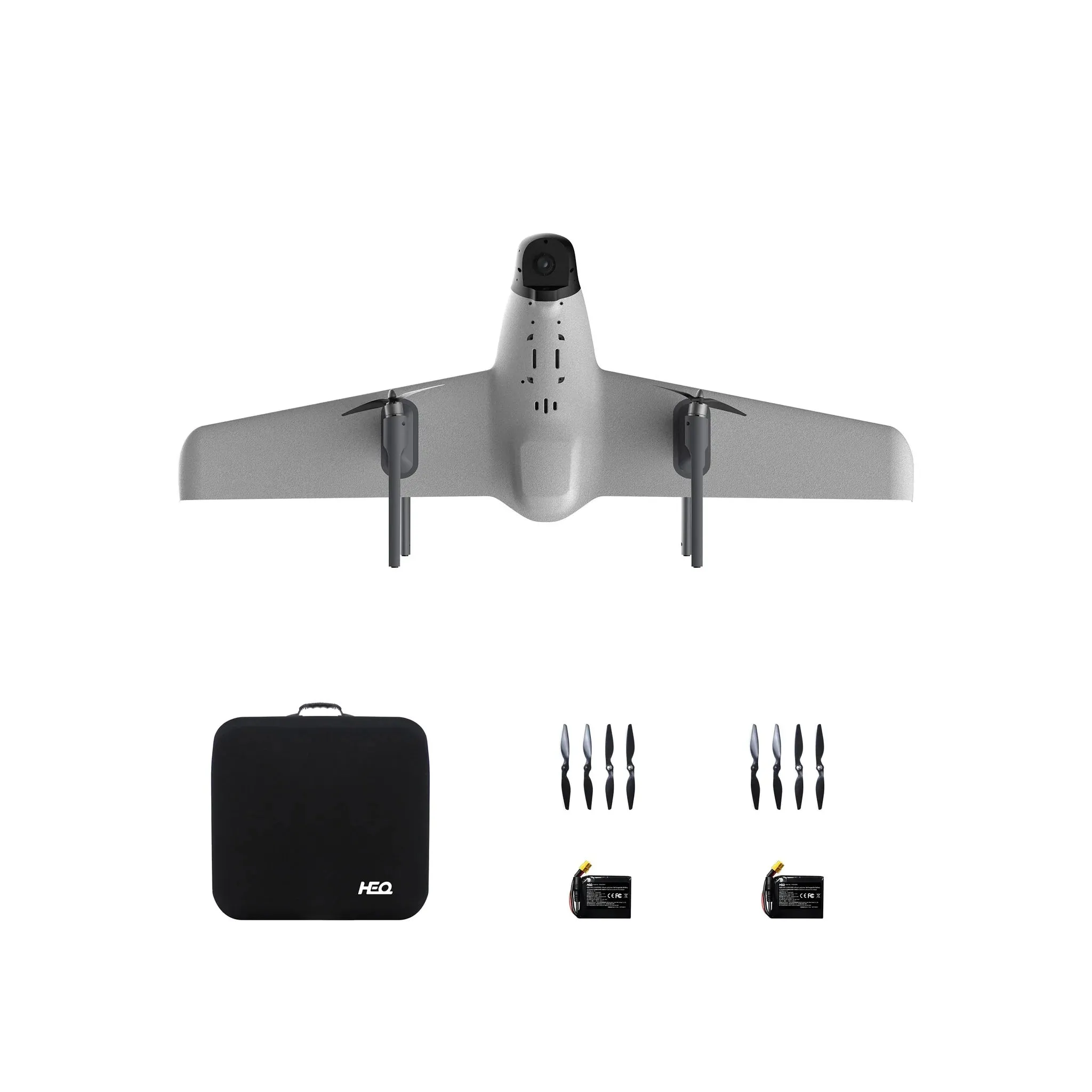
What's in the box?
1x Swan-K1 Mapping aircraft
1x set of quick detachable nylon propellers
1x Radio controller(with HD touch screen)
1x Carry case
1x 5500mAh 15.2V Lipo Battery
1x Power charger
1x Aircraft User Manual and Disclaimer
1x Custom 24 Mega pixels SONY camera
1x PPK module
Specifications
Camera
Size
75×65×90mm(including 25mm lens)
Weight
220g( including lens)
Pixel
24.3 million pixels
Camera frame
APS frame
Sensor size
23.5×15.6mm
Maximum resolution
24MP
Lens mount
Sony E mount
Access current
2~7S 10~30V
PPK module
Operating temperature
-30~ 75℃
GNSS signal
GPS、GLONASS、BDS、Galileo
GNSS channel
72
Update rate
5Hz
Input voltage
5V
Antenna voltage
3.3V
Average current
25mA
Data storage
16GB
Data Format
RINEX
Antenna interface
Mcx
Light
Trigger, satellite, storage, power
Horizontal accuracy
2cm 1ppm
Vertical accuracy
4cm 1ppm
Work efficiency
Overlap rate
80%×70% Resolution 5/10/20 cm 60mins flight time
1:500 Flying height 210m
2-3 square kilometers per flight
1:1000 Flying height 420m
4-5 square kilometers per flight
1:2000 Flying height 840m
8-9 square kilometers per flight
Operation accuracy
1:500 Without ground control points
Horizontal accuracy≤ 5cm
Vertical accuracy≤ 5cm
1:1000 Without ground control points
Horizontal accuracy≤ 8cm
Vertical accuracy≤ 10cm
1:2000 Without ground control points
Horizontal accuracy≤ 15cm
Vertical accuracy≤ 20cm


